
IMPORTANT: Follow the direction of state, local, and tribal officials.
- Florida State Emergency Response Team (SERT)
- Seminole Tribe of Florida - Emergency Management Division
- Miccosukee Tribe of Indians of Florida
- Find a Hurricane Shelter - You can use the FEMA app to find a shelter near you or text SHELTER and your ZIP code to 4FEMA (43362). Message and data rates apply.
Preparedness & Safety (Tips by FEMA)
-
Storm surge is often the greatest threat to life and property from a tropical system. It poses a significant threat for drowning and can occur before, during, or after the center of a storm passes through an area. Storm surge can sometimes cut off evacuation routes, so do not delay leaving if an evacuation is ordered for your area. Three to five feet of storm surge are expected.
-
There is the potential for flooding with this storm. Driving through a flooded area can be extremely hazardous and almost half of all flash flood deaths happen in vehicles. When in your car, look out for flooding in low-lying areas, at bridges and at highway dips. As little as six inches of water may cause you to lose control of your vehicle. Four to eight inches of rain are expected, with 10 inch totals in isolated locations.
-
If you encounter floodwaters, remember – turn around, don’t drown.
-
Be familiar with evacuation routes, have a family communications plan, keep a battery-powered radio handy and have a plan for pets. Visit www.ready.gov or www.listo.gov to learn these and other preparedness tips for tropical storms.
-
Know your evacuation zone and be sure to follow the direction of state, local, and tribal officials if an evacuation is ordered for your area.
-
If you have a National Flood Insurance Program (NFIP) flood policy, you may be eligible for reimbursement of actions taken to protect your property. Call your NFIP insurance agent to find out more.
-
Get to know the terms that are used to identify severe weather and discuss with your family what to do if a watch or warning is issued.
Resource Pages:
- Federal Emergency Management Agency (FEMA)
- FEMA's list of social media accounts to follow for Hurricane Irma
- Apply for assistance through the Disaster Assistance Improvement Program (DAIP)
- Find news, info, and other assistance on USA.gov
- OST Trust Beneficary Recipients: Contact the Trust Beneficiarly Call Center (1-888-678-6836) to update your address. Visit the OST website for more information.
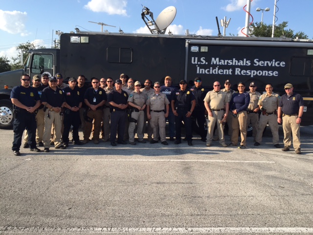
Update from the Field
|
|
|
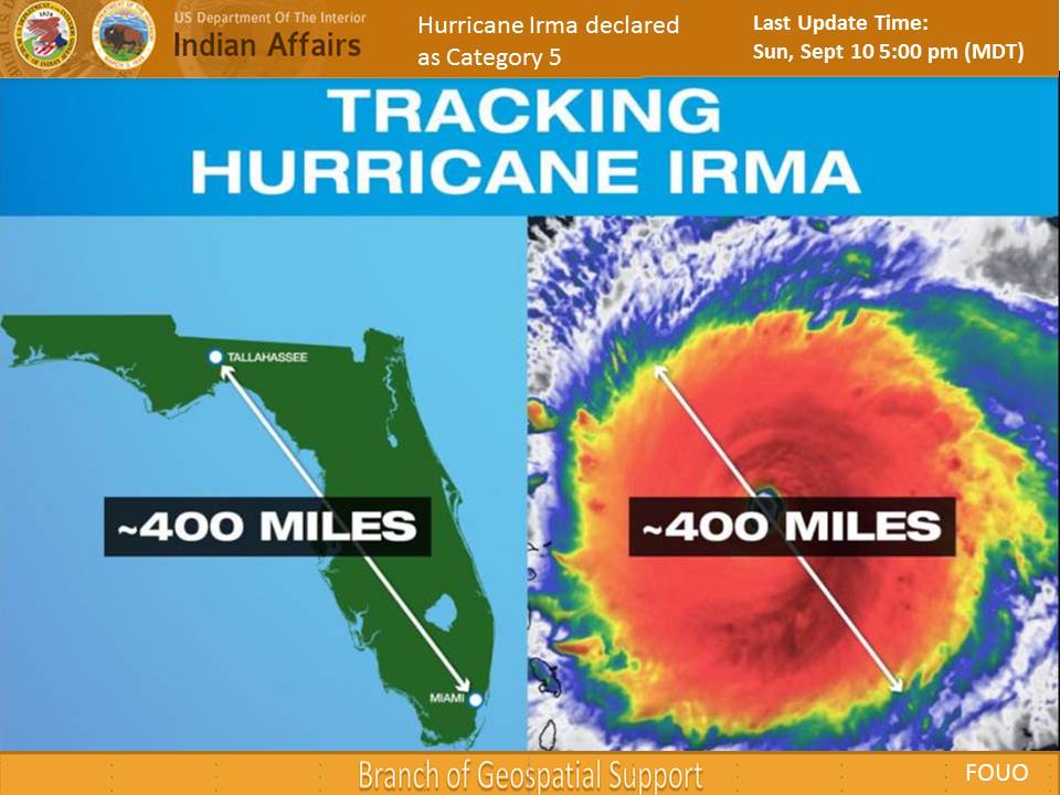
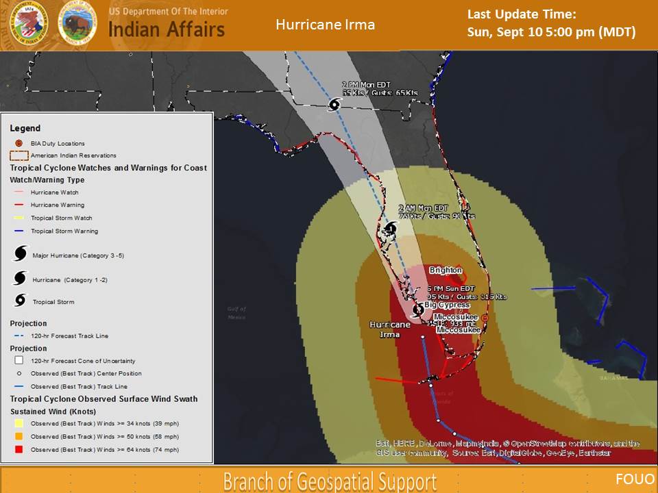
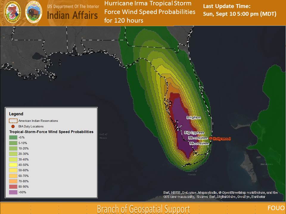
NEW: Hurricane Irma GIS Updates (related to tribal communities)
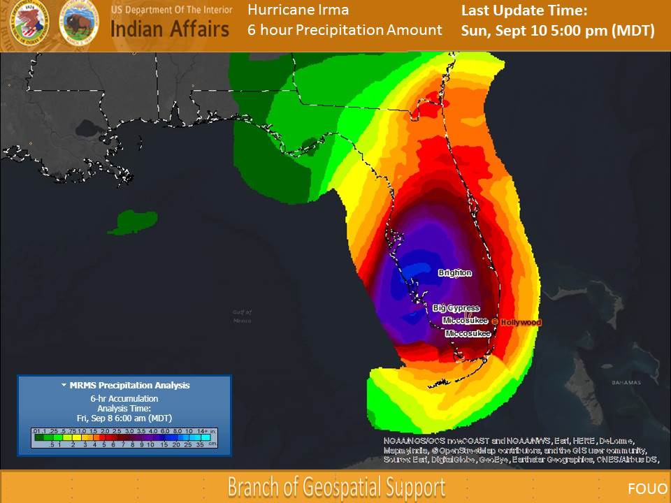
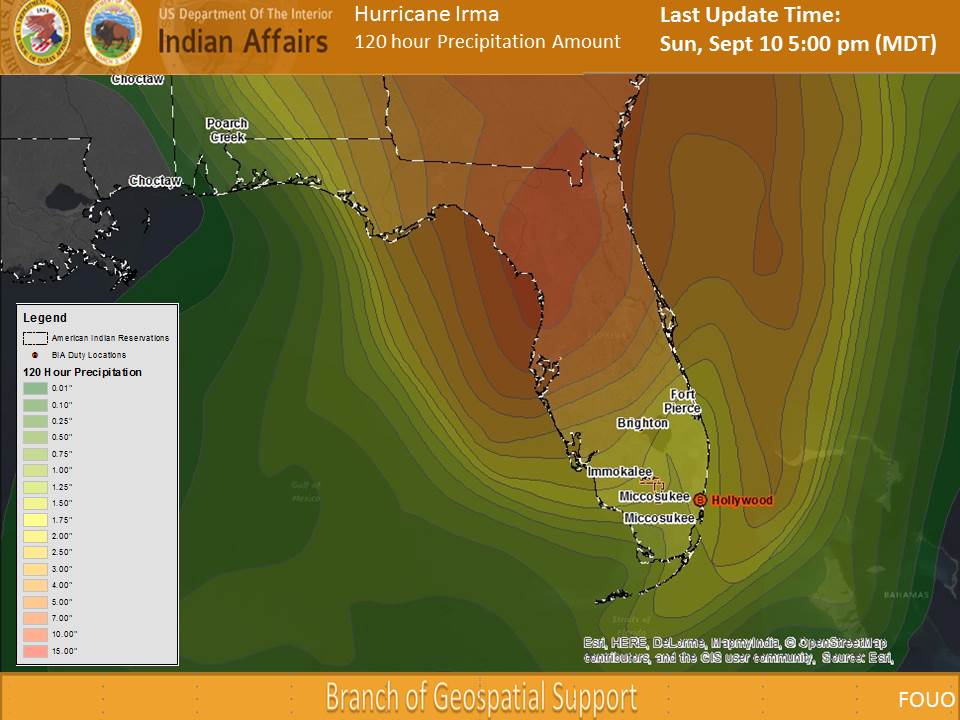
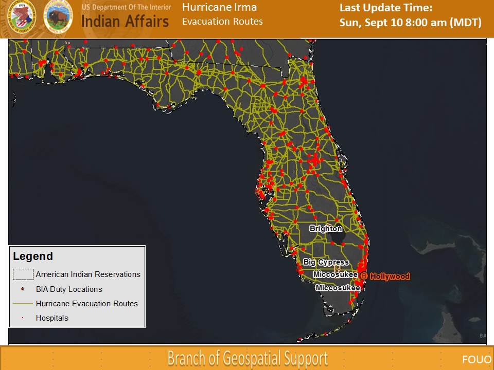
The BIA Branch of Geospatial Support has created an informational map showing the storm's movement over tribal communities.
Note: The map is for informational purposes only.
Tracking Hurricane Irma Report - Indian Affairs
(Will be updated by 1:00 ET on Saturday and Sunday)
The latest report (September 10, 2017 at 5:00 PM MDT) on tracking Hurricane Irma by the BIA Branch of Geospacial Support.
Note: Clicking on the photos will download the powerpoint file.

Previous Reports on Tracking Hurricane Irma:
September 10, 2017 at 8:00 AM MDT (Powerpoint)
September 09, 2017 at 2:00 PM MDT (Powerpoint)
September 09, 2017 at 9:01 am MDT (Powerpoint)
September 08, 2017 at 9:01 am MDT (Powerpoint)